Grand Central Restoring Innercity Rail Service; Phone Booth Exhibit in Times Square; Tons of Oysters on Governors Island

Grand Central Terminal
Photo: viewingnyc

There is a lot of stuff going on the City, and we can't write about it all. Here are some interesting things some of our friends have written up lately.

  • 6sqft ⇒ Grand Central Will Temporarily Restore Intercity Rail Service for the First Time in 26 Years
  • Bowery Boogie ⇒ Clayton’s Corner: Experiencing the ‘Matapaloz Festival’ Firsthand [Photos]
  • Brooklyn Based ⇒ Brooklyn Is Hungry and Gotham Market at the Ashland Has the Chow - Brooklyn Based
  • Curbed NY ⇒ Could Height Limits on NYC Skyscrapers Be in the City’s Future?
  • Daytonian in Manhattan ⇒ The Port Warehouse Bldg - Nos. 54-58 Laight Street
  • EV Grieve ⇒ A Renewed Effort to Restore and Preserve the Yiddish Theatre Walk of Fame on 2nd Avenue
  • Free Williamsburg ⇒ Motor Teresa Blesses Brooklyn With "Instrumetal" Madness – Free Williamsburg
  • Gothamist ⇒ Gigantic Palm Tree-Filled Venue Brings L.A. To Brooklyn
  • Governors Island ⇒ Island Oyster Grand Opening
  • Laughing Squid ⇒ Manhattan Moonrise, a Stunning Shot of the Strawberry Moon Rising Over Lower Manhattan
  • New York Times ⇒ Phone Booths Are Back in Times Square. No Quarters Required.
  • The Lo-Down ⇒ Wizard of Oz Comes to Seward Park July 15 | the Lo-Down : News From the Lower East Side
  • Thrillist ⇒ Secrets Your NYC Real Estate Broker Won't Tell You
  • Untapped Cities ⇒ World War II Bomb Shaped Time Capsule Unearthed in Flatiron District
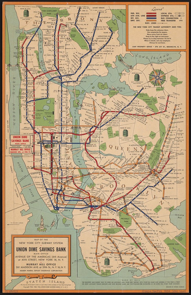
[MAPS] Vintage Map Shows New York City Subway System in 1954

Map of the New York City subway system, 1954
Photo: LOC

This vintage New York City subway map from 1954 shows the three separate private transit services—IND, IRT, and BMT—that would eventually combine to form the single MTA subway system we have today. The map was produced by the Union Dime Savings Bank, a financial powerhouse in the City from 1859 through the 1970s.

Check out the specimen page on the Library of Congress Digital Archives for more info on the map.

[VIDEO] Learn All About the Brooklyn Navy Yard's Gradual Transformation in This Short Report

The Brooklyn Navy Yard is a former military hub that was used extensively during the 19th century through World War II and the years following. When the Navy moved out in the 1960s, the area was left with tons of open warehouses and facilities that have since been repurposed into an industrial and manufacturing hub for up-and-coming Brooklyn businesses. Learn all about the slow changes to the neighborhood in this short report from Monocle Films.

From urban farming to robotics, we take a tour around the Brooklyn Navy Yard to see how this vast shipyard has rebuilt its industry and community once more.