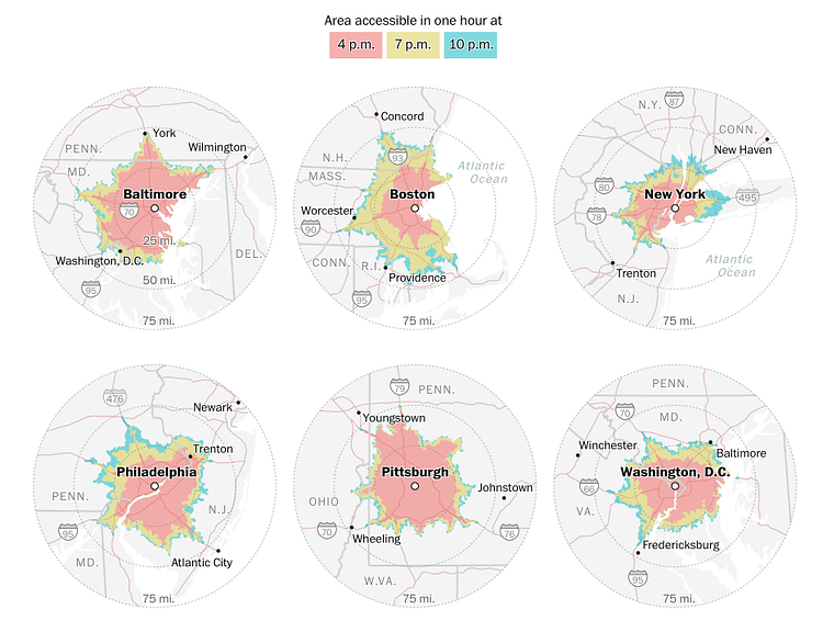
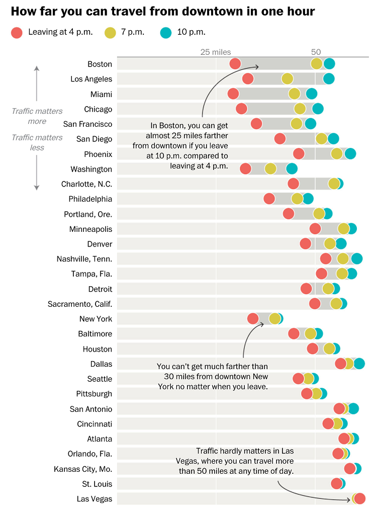
The Washington Post recently published a great article featuring many data visualizations showing how far one can travel by car in one hour from major U.S. metropolitan areas at three times surrounding rush-hour. Looking at the difference between these times in each city helps to visualize which cities have the most variance due to traffic jams.
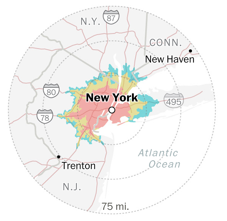
For instance, Boston has a rush-hour average distance of about 30 miles from downtown, where at 10pm you can go about 50 miles. Traveling one hour in Las Vegas on the other hand gets you nearly 50 miles at all times of day, making traffic a non-factor. New York City is solidly in the middle of the pack, with an average low-distance of about 20, going up to about 30 miles, meaning the time you leave really doesn't matter that much... traffic always sucks!
Check out the full article for more graphs, charts and analysis on the "escape time" of each major U.S. city.
via Washington Post

Matt Coneybeare
Editor in Chief
Matt enjoys exploring the City's with his partner and son. He is an avid marathon runner, and spends most of his time eating, running, and working on cool stuff.
Something wrong with this post? Let us know!


