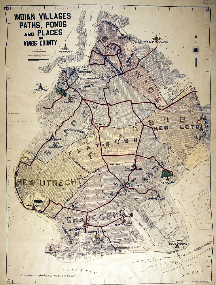
It's no secret that the New York City area used to be inhabited by Native American tribes before the Dutch and English pushed them out. The tribes had been settled here for centuries if not millennia, and over that time, some foot paths had been etched in the dirt as means to get from area to area. These paths were mapped out in 1946 by James A. Kelly, who served as the Borough of Brooklyn Historian from 1944 to 1971.
Our friends at the Brooklyn Heights Blog recently dug up the old map and did a bit of analysis on it, noting that many of those same paths evolved into the main arteries that dissect Brooklyn neighborhoods today.
Interesting to see some of the trails that exist today as major thoroughfares, like Fulton Street, Flatbush Avenue and part of Atlantic Avenue. [...] the Werpos village of the Indian burial ground had a twin village located around today’s City Hall. [...] One other site I noticed was a park extending from Columbia Street to Smith Street, and from Atlantic Avenue to Kane Street (and labeled as “Sassians” on the map). I guessed it was park of today’s Van Voorhees park, and indeed nycgovparks.org has more information.

Matt Coneybeare
Editor in Chief
Matt enjoys exploring the City's with his partner and son. He is an avid marathon runner, and spends most of his time eating, running, and working on cool stuff.
Something wrong with this post? Let us know!

