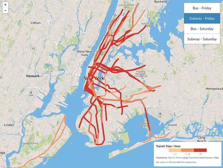
The New York City Transit Frequency Map is an interactive mapping tool from public transit enthusiast Tyler A. Green to help you visualize delays throughout the New York City transit system of buses and subway lines.
Stop the buses! Hold the phone! I now have visual proof that buses and subways in the Big Apple run more often on Fridays than Saturdays. How insightful, right? Okay, so maybe not, but I still enjoyed making a New York City transit frequency visualization using Transitland and Mapbox.
Check out the full map, then read all about the methodology and analysis in the accompanying article.
h/t 6sqft

Matt Coneybeare
Editor in Chief
Matt enjoys exploring the City's with his partner and son. He is an avid marathon runner, and spends most of his time eating, running, and working on cool stuff.
Something wrong with this post? Let us know!


