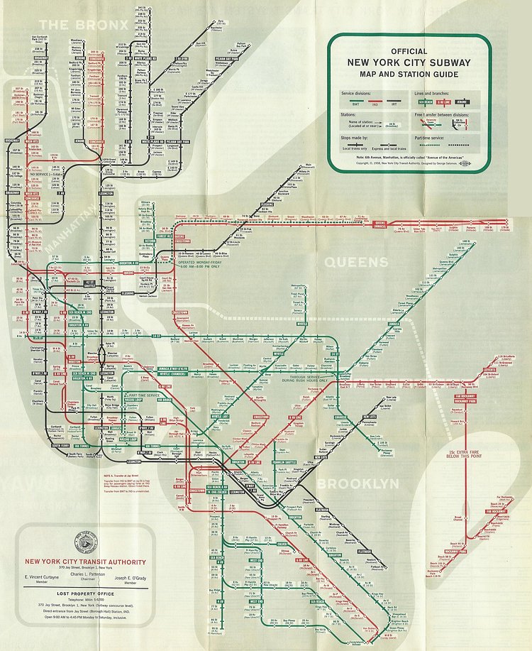
Before the modern day, single subway system, New York City had three separate, independently operated subway companies: the Interborough Rapid Transit Company (IRT), the Brooklyn–Manhattan Transit Corporation (BMT), and the Independent Subway System (IND). This vintage subway map was created in 1958 by the New York City Transit Authority and attempts to clearly show all three services and all of their stops, yet ended up with a rather confusing system of red, green, and black lines.
via reddit

Matt Coneybeare
Editor in Chief
Matt enjoys exploring the City's with his partner and son. He is an avid marathon runner, and spends most of his time eating, running, and working on cool stuff.
Something wrong with this post? Let us know!


