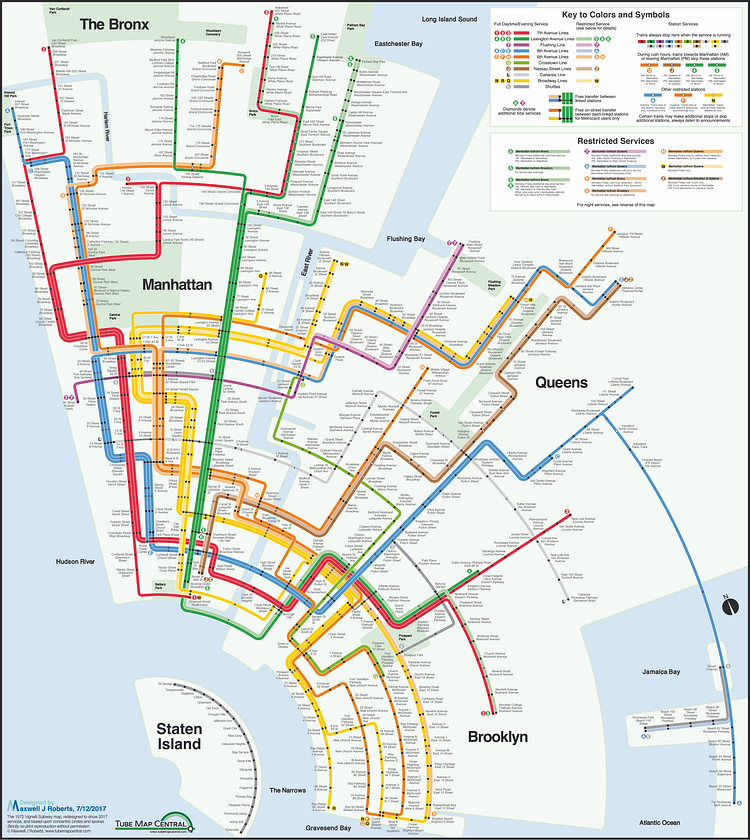
Map designer Max Roberts of Tube Map Central recently re-released his popular Concentric Circle New York City Subway map in the style of famous NYC subway map designer Massimo Vignelli and the results are stunning.
The result of this strange fusion is a completely original design. The Vignelli style of individually shown routes causes thick bands that crowd Manhattan, necessitating a wider island and a lower point of radiation than my previous circles map. I needed five attempts at Manhattan before I was happy, but the unintended consequence was a rather nice solution for Staten Island. Overall, the creation of the layout was straightforward: Start at Lower Manhattan and work upwards to the top of Bronx to give the map its dimensions, trying to keep the design regular and compact, then across to Brooklyn and the horrible tangle of lines converging and diverging along Flatbush Avenue, and then on to the more forgiving, but not trivial, mesh down to Coney Island, then up to north-west Queens (and resignation to the extreme distortion necessary along Queens Boulevard). In terms of the fine details, this turned out to be the most fiddly circles map I have ever created, with many lines of station dots and line labels lying on circular arcs.
via Tube Map Central

Matt Coneybeare
Editor in Chief
Matt enjoys exploring the City's with his partner and son. He is an avid marathon runner, and spends most of his time eating, running, and working on cool stuff.
Something wrong with this post? Let us know!


