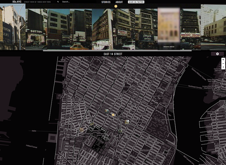
80s.nyc is a cool new website which uses old property photos from the publicly accessible digital archives of the New York City Department of Finance to create a Google StreetView-like map showing what New York City looked like block-by-block in the 1980s. The photos were originally taken to assess property value, a common practice in the City since the 1930s, yet only the ones taken in the mid-80s and beyond were digitized.
Over 5 years in the mid-1980s, the City of New York photographed every property in the five boroughs. The project had a bureaucratic origin: the photos would be used by the Department of Finance to estimate real property values for taxation purposes. Buildings as well as vacant lots were photographed, as they’re both taxed - and because it was difficult to distinguish while shooting between taxable and tax-exempt buildings like religious institutions or government offices, the photographers just shot everything. The result was a remarkable body of imagery – over 800,000 color 35mm photos in both negative and print formats.
Check out the full interactive map to see what your neighborhood really looked like in the 1980s.

Matt Coneybeare
Editor in Chief
Matt enjoys exploring the City's with his partner and son. He is an avid marathon runner, and spends most of his time eating, running, and working on cool stuff.
Something wrong with this post? Let us know!


