Our friends at Atlas Obscura recently published a great article and accompanying map about the history of rioting in New York City titled New York City's History of Resistance, in One Riotous Map.
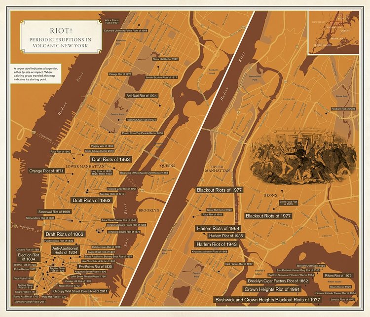
But New York’s history is riddled with popular uprisings and violent clashes. The map above, designed by Molly Roy and originally published in Rebecca Solnit and Joshua Jelly-Schapiro’s new book, Nonstop Metropolis: A New York City Atlas, shows how walking through the city—especially lower Manhattan—means passing over past sites of political violence, where people took to the streets with their demands.
Check out the full article and map for more info.
via Atlas Obscura

Matt Coneybeare
Editor in Chief
Matt enjoys exploring the City's with his partner and son. He is an avid marathon runner, and spends most of his time eating, running, and working on cool stuff.
Something wrong with this post? Let us know!


