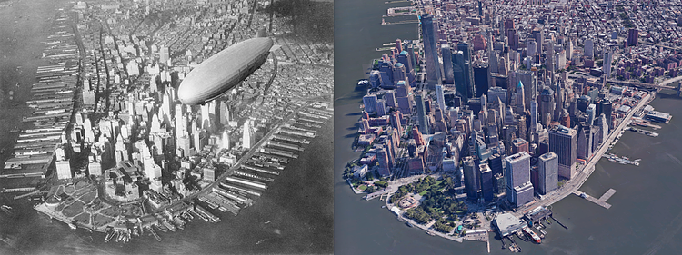
This great side-by-side comparison of Lower Manhattan shows an aerial photograph from 1930 versus a satellite image at relatively the same angle, from Google Earth. Aside from the skyline growth, a major difference is the elimination of nearly every dock on the East and Hudson Rivers. As trade moved more to train and truck transit, the old shipping docks were no longer needed and most were torn down. All of New York City's shipping trade in modern times comes in through Brooklyn and New Jersey.
via r/nycpics

Matt Coneybeare
Editor in Chief
Matt enjoys exploring the City's with his partner and son. He is an avid marathon runner, and spends most of his time eating, running, and working on cool stuff.
Something wrong with this post? Let us know!

