Thousands of Manhattan's tall buildings now have a problem.
Check Out This Incredible Map of Lower Manhattan Circa 1870
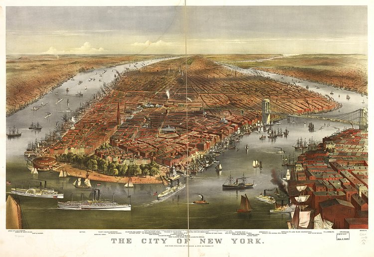
Photo:
Library of Congress
This map, created and published in 1870 by printmakers Currier & Ives, shows Manhattan, Brooklyn and bits of Queens as seen from a birds eye view over New York Harbor. Zooming in, many of the locations drawn are labeled below. For more on the map, including larger scans and prints, check out its specimen page in the Library of Congress archives.
[VIDEO] The Real Five Points, The Neighborhood That Inspired 'Gangs of New York'
Martin Scorsese's period epic Gangs of New York took up residence in the chaos-ridden New York City neighborhoods of the mid-1800s, populated by eccentric characters and vicious acts of aggression. Its depiction wasn't entirely accurate, but it was based on a very real neighborhood and the very real misery it experienced. Five Points, a major intersection in lower Manhattan, was home to a host of impoverished immigrants seeking a better future for their families. That future wasn't easy to come by; newcomers mostly encountered hostility and distrust, which often boiled over into conflict.