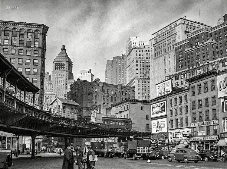
Vintage Photograph Shows Famous Elevated Train S-Curve at Lower Manhattan's Coenties Slip in 1941

Coenties Slip, Lower Manhattan, December 1941
Photo: r/nyc

This great vintage photograph from 1941 shows the famous "S-Curve" at Coenties Slip, in Lower Manhattan, December of 1941. In this spot, the former 2nd and 3rd Avenue elevated trains ran through this curve until 1950, when it was dismantled. Currently, the area is an open plaza called Coenties Slip Park, seen here in this Google StreetView showing how it looks today from approximately the same spot:

Major Map Data Supplier Hacked, Renamed New York City to 'Jewtropolis'

If you used an app yesterday that included mapping screens, you may have noticed something awry with our City's name. Major apps such as Zillow and Snapchat pull their map data from a company called MapBox, and that company allowed somebody to edit the city's name to the ethnic slur 'Jewtropolis'.

Users of popular apps including Snapchat and StreetEasy were stunned Thursday morning to see New York City replaced on some maps with a new label — "Jewtropolis." Screenshots posted to social media showed a wide variety of apps appeared to be affected, depending on how closely people zoomed into maps of the city.

The edits have since been corrected.