[VIDEO] City of Dreams, A Stunning Vignette of New York City Aerials and Street Scenes

Local filmmaker Tim Kellner has been featured a few times on Viewing NYC. From exploring midtown rooftops to touring an empty Metropolitan Museum to spending a day on the Coney Island Boardwak, Kellner always creates amazing videos with great soundtracks, and this is no exception. Titled City of Dreams, this 2017 short film blends aerial captures of the City with street scenes, romance, models, artists and more in a stunning way. Check it out!

A film for the dreamers of New York City.
Interactive New York City Street Tree Map Lets You Visualize the Nature Data for Your Neighborhood

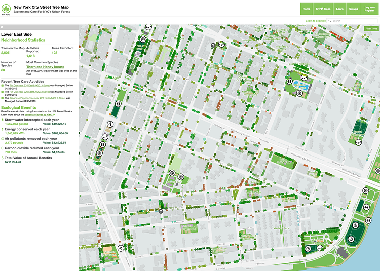
New York City Street Tree Map (screenshot)
Photo: NYC Parks

The New York City Street Tree Map is a new, interactive data visualization tool from NYC Parks that lets you explore the trees and nature on any given block in the City. Using data collected in 2015 by volunteers, and updated daily by the department's Forestry team, the maps breaks down the map by species so you can see exactly what types of trees you are looking at.

The New York City Street Tree Map is the world’s most accurate and detailed map of a city’s street trees. Through this map, you can explore our city’s urban forest, mark trees as favorites and share them with your friends, and record and share all of your caretaking and tree stewardship activities.

Check out the interactive map to play around with the data and see what trees are in your neighborhood.