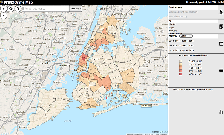
The New York Police Department, in accordance with the City's
Open Data initiative, has created an interactive map of crime levels, broken down by
precinct.
Crime data is provided in map format for the, “seven major NYS Penal Law felonies” (Murder and Non-Negligent Manslaughter, Rape, Robbery, Felonious Assault, Burglary, Grand Larceny and Grand Larceny Motor Vehicle)
They offer filters for the above crime records, including date filters and felony-specific filters.
A crime map can be presented cumulatively year to date, previous year cumulative and by any specific month in either period. The opening and default map views are of the most recent full month count of all seven major crimes.
Check out the crime map in full-screen for the best interaction.
via NYTimes

Matt Coneybeare
Editor in Chief
Matt enjoys exploring the City's with his partner and son. He is an avid marathon runner, and spends most of his time eating, running, and working on cool stuff.
Something wrong with this post? Let us know!


