Our little patch of dirt is obviously the best city out there. Nobody has more love for their city than New Yorkers, but have we always thought this way?
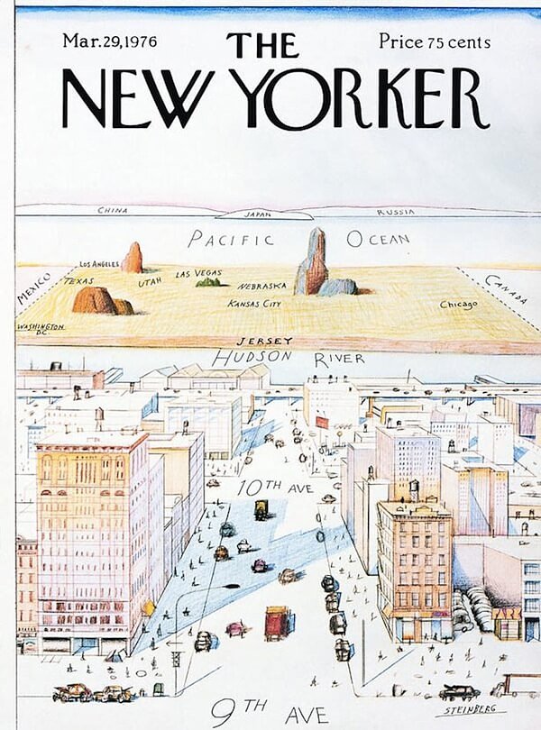
This cartoon cover for the March 29th, 1976 edition of The New Yorker seems to prove that we have, at least for the past 40 years that is.
The map shows how New Yorkers might see the rest of the world if they faced west on 9th Avenue. Thus, 10th Avenue and the Hudson river are clearly shown, but beyond that it’s just a bit of a blur. Canada and Mexico both make it onto the map, sandwiching a very rectangular United States.
via Brilliant Maps

Matt Coneybeare
Editor in Chief
Matt enjoys exploring the City's with his partner and son. He is an avid marathon runner, and spends most of his time eating, running, and working on cool stuff.
Something wrong with this post? Let us know!


