Thanks to The New York Public Library Digital Collections, the public has access to thousands of images of New York City from the 1870’s to the 1970’s. Today we’re sharing some of our favorites of The Bronx where you can see how things have changed—or not.
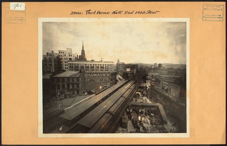
Third Avenue at 148th Street in The Hub looking north towards Melrose in 1926. Many of the buildings in this image still stand including Immaculate Conception Church (minus its steeple). Long gone is the Third Avenue El which left a gaping transit desert in Morrisania and other points north / Image Credit: Irma and Paul Milstein Division of United States History, Local History and Genealogy, The New York Public Library. “Bronx: 3rd Avenue – 148th Street (East)” The New York Public Library Digital Collections. 1926.
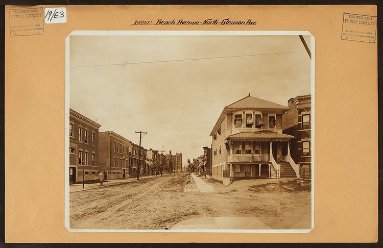
Beach Avenue looking north at Gleason Avenue in Soundview in 1915. At the end of the street you can see PS 47 which still stands but today would barely be visible from this same vantage point as the 6 train obscures the view. Image Credit: Irma and Paul Milstein Division of United States History, Local History and Genealogy, The New York Public Library. “Bronx: Beach Avenue – Gleason Avenue” The New York Public Library Digital Collections. 1915.
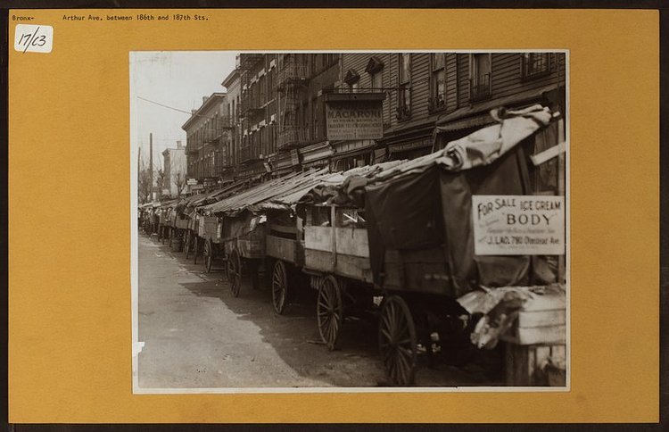
Arthur Avenue in Belmont between E 186th and E 187th Street (date unknown) Image Credit: Irma and Paul Milstein Division of United States History, Local History and Genealogy, The New York Public Library. “Bronx: Arthur Avenue – 186th Street” The New York Public Library Digital Collections.
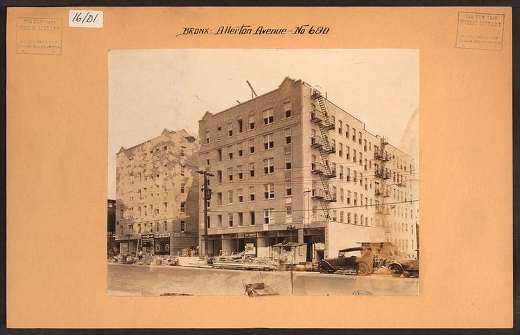
Apartment buildings under construction along Allerton Avenue and White Plains road (you can see a sliver of the 2 line to the left of the image) in 1930. Image Credit: Irma and Paul Milstein Division of United States History, Local History and Genealogy, The New York Public Library. “Bronx: Allerton Avenue – White Plains Road” The New York Public Library Digital Collections.
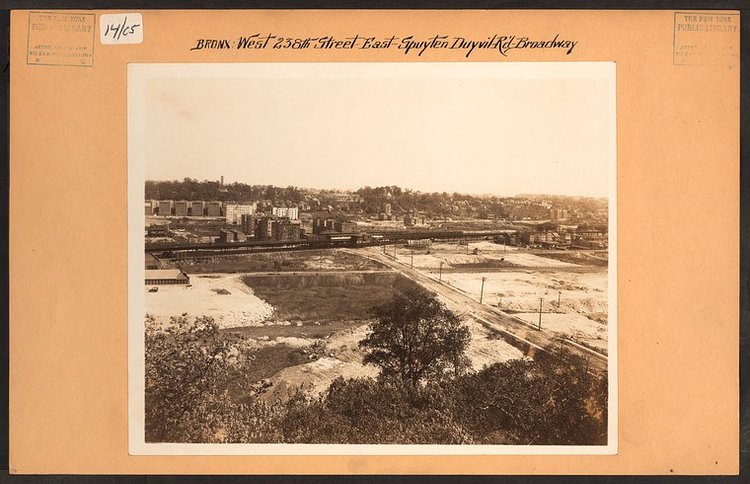
1924 image West 238th Street in Riverdale facing east towards Broadway were you can see the 1 subway line running through mostly empty lands to the west of Broadway. The photographer noted the landfills being prepped for “extensive real estate development”. A lot of this development which occurred throughout The Bronx was in fact due to the expansion of the subway system throughout our borough. Image Credit: Irma and Paul Milstein Division of United States History, Local History and Genealogy, The New York Public Library. “Bronx: 238th Street (West) – Spuyten Duyvil Road” The New York Public Library Digital Collections. 1926.
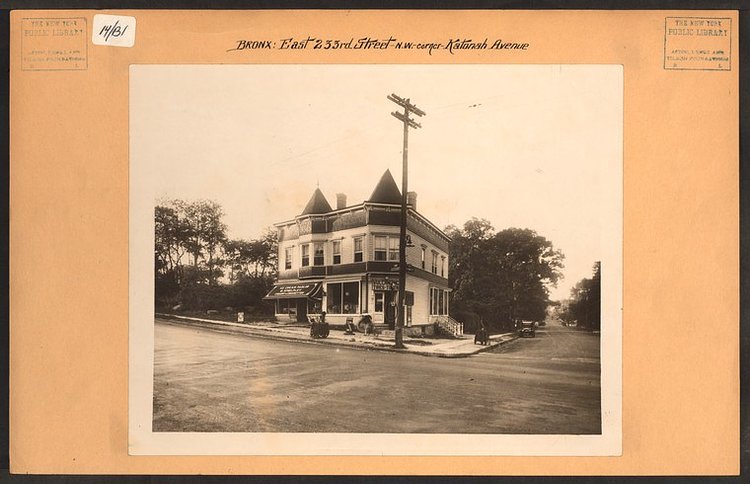
E 233rd Street at Katonah Avenue in Woodlawn, 1924 / Image Credit: Irma and Paul Milstein Division of United States History, Local History and Genealogy, The New York Public Library. “Bronx: 233rd Street (East) – Katonah Avenue” The New York Public Library Digital Collections. 1924.
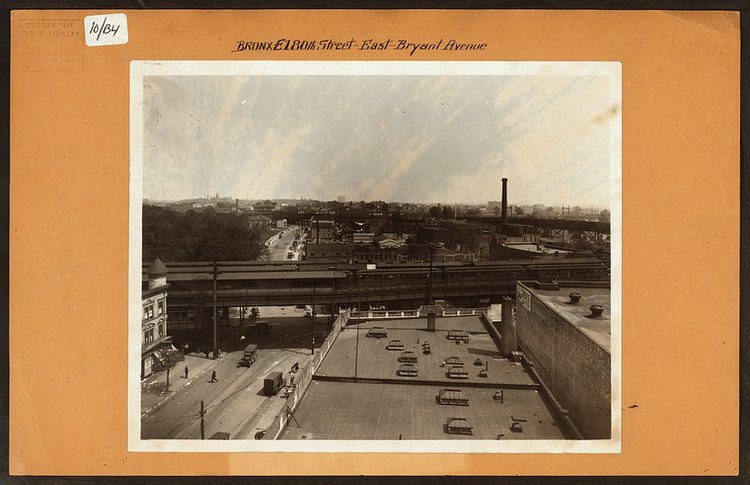
East 180th Street on Bryant Avenue. The El you see, however, is NOT East 180th Street on Morris Park on the 2/5 train but the old Bronx Park Terminal of the 7th Avenue IRT on Boston Road. In the distance you can see the East 180th Street station which is now the 2/5 line.(1926) Irma and Paul Milstein Division of United States History, Local History and Genealogy, The New York Public Library. “Bronx: 180th Street (East) – Bryant Avenue” The New York Public Library Digital Collections. 1926.
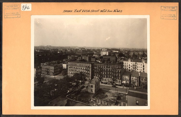
E 178th Street and Hughes Avenue in Tremont (Date Unknown) Image Credit: Irma and Paul Milstein Division of United States History, Local History and Genealogy, The New York Public Library. “Bronx: 178th Street (East) – Hughes Avenue” The New York Public Library Digital Collections.
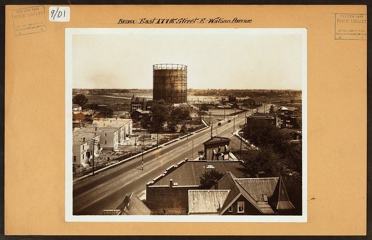
The semi-rural neighborhood of Castle Hill at Watson Avenue and what would become the infamous Cross Bronx Expressway. (1926) Image Credit: Irma and Paul Milstein Division of United States History, Local History and Genealogy, The New York Public Library. “Bronx: 177th Street (East) – Watson Avenue” The New York Public Library Digital Collections. 1926.
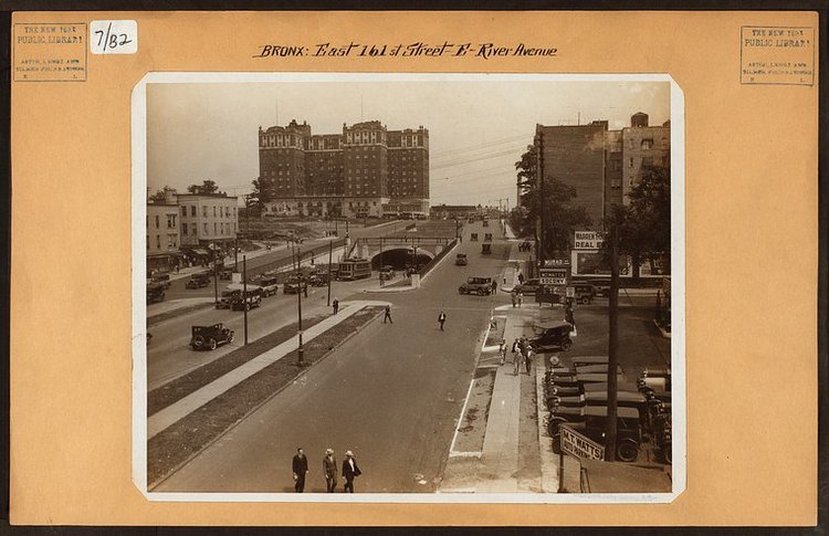
161st Street looking East towards the Grand Concourse and the Concourse Plaza Hotel / Image Credit: Irma and Paul Milstein Division of United States History, Local History and Genealogy, The New York Public Library. “Bronx: 161st Street (East) – River Avenue” The New York Public Library Digital Collections. 1926.
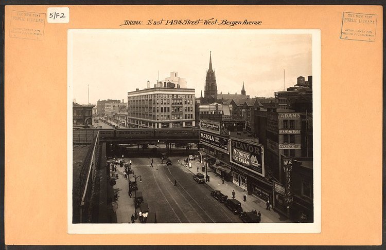
Also taken in 1926, this image of 149th Street and The Hub in Melrose looking West with Immaculate Conception Church standing as the tallest structure for miles. / Image Credit: Irma and Paul Milstein Division of United States History, Local History and Genealogy, The New York Public Library. “Bronx: 149th Street (East) – Bergen Avenue” The New York Public Library Digital Collections. 1926.
Matt enjoys exploring the City's with his partner and son. He is an avid marathon runner, and spends most of his time eating, running, and working on cool stuff.