Photo:
Bernard Ratzer / Thomas Kitchin
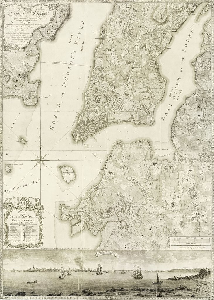
Historia Posters has some pretty interesting old maps of the City. This one, designed by cartographer Bernard Ratzer and engraved by Thomas Kitchin, shows Manhattan and Parts of Brooklyn as it was before the American Revolution. There is also an intricate drawing of Manhattan as it appears from Governor's Island.
The original map can be seen at the New York Public Library, but Historia offers it as prints or on canvas.
via reddit

Matt Coneybeare
Editor in Chief
Matt enjoys exploring the City's with his partner and son. He is an avid marathon runner, and spends most of his time eating, running, and working on cool stuff.
Something wrong with this post? Let us know!
